
Upper Mobile River Bulkhead Repair: Saraland, Chickasaw and Creola
Bulkhead repair on the upper Mobile River starts with one question: which city issues your permit? The lines here run in odd places, and the City of Mobile reaches farther north than most owners expect.
Describe your project on this page ↓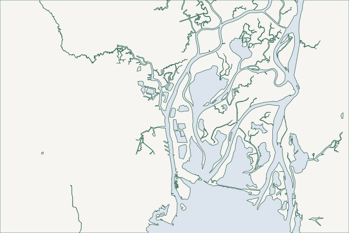
Chickasaw Creek, Bayou Sara & the upper river at a glance
- Who permits it
- The City of Mobile at creek mouths; Chickasaw, Saraland, Satsuma, Prichard or Creola upstream
- Call first
- Build Mobile, (251) 208-5895
- The water
- Chickasaw Creek reached 4.9 ft above MHHW in Nate and 5.2 ft below it in Sally
- Local rule to know
- Creola sets the lowest floor a full foot over base flood elevation
Get to know your waterfront
Frontage on the upper Mobile River is split among the City of Mobile, five smaller cities and the county. The permit office changes from creek to creek. The water is river and creek with AE flood zones and no V zones, yet channel traffic and storm swings still load a wall.
TIGERweb Places, layer 4, point-in-polygon tests at USGS GNIS stream-mouth coordinates · National Flood Hazard Layer, layer 28 (flood hazard zones), envelope queries · CO-OPS Metadata and Data APIs: Chickasaw Creek 8737138
Who permits your wall, and what the river does to it
The mouth of a creek and the reach just upstream can sit in different cities. Sort that out before you price anything.
Who issues a bulkhead permit on the upper Mobile River?
Census city limits for Mobile run north along the industrial river corridor to roughly latitude 30.84. That puts the mouths of Chickasaw Creek, Shell Bayou, Threemile Creek, Bayou Sara and Catfish Bayou roughly inside the City of Mobile. Census city boundaries
The smaller cities start upstream. Census maps place Eightmile Creek's mouth in Chickasaw and Seabury Creek's mouth in Prichard. The mouths of Gunnison Creek, Steele Creek and Little Catfish Bayou are unincorporated. Census city boundaries
| Where | Office | Phone |
|---|---|---|
Creek mouths in Mobile | Build Mobile, Government Plaza | (251) 208-5895 |
Saraland (Bayou Sara) | Building Department, Saraland Blvd. S. | (251) 679-5502 |
Satsuma | Building Inspection, City Hall | (251) 675-1440 ext. 5307 |
Chickasaw | Building Department, N. Craft Hwy. | (251) 452-6450 |
Prichard | Inspections, through the 3-1-1 line | (251) 452-7841 |
Creola | Building Inspector | (251) 454-0281 |
These lines are a map-layer reading, not a parcel ruling. The owner confirms the office with the parcel number, then asks whether a bulkhead repair needs a permit at all, in writing. Contractor rules differ by town:
- Satsuma licenses every contractor, and a general contractor on a job of $10,000 or more also needs a state home builder license. Satsuma contractor rules
- Chickasaw wants a city business license from any contractor working there. Chickasaw building office
- Prichard asks for a city license under $50,000 and a state general contractor license above that. Prichard inspections
What does the water do on this stretch?
The flood map shows AE zones here and no V zones. Near Chickasaw the creek sits at AE 11 and 12 feet on the NAVD88 scale (the national survey height system). Bayou Sara and the Creola river edge show AE 10 to 11 feet, with floodway and reaches that carry no printed base elevation. FEMA flood map
The Chickasaw Creek gauge (8737138) has a tide range of only 1.7 feet. Heights here are measured from MHHW, the mean higher high water level. Minor flooding starts at 1.7 feet above that mark. NOAA gauge 8737138
- Nate in 2017 reached 4.9 feet above that line. NOAA gauge 8737138
- Zeta in 2020 reached 4.5 feet. NOAA gauge 8737138
- Ida in 2021 reached 3.5 feet. NWS Ida summary
- Sally in 2020 did the reverse: north wind pulled the creek to 5.2 feet below the line. NOAA Sally readings
Rain adds to the surge. In Gustav, 6 to 9 inches of rain could not drain through high tides, and 53 Bayou Sara residents in Saraland were evacuated. NWS Gustav summary
How does shipping change a wall design?
The lower creeks are working waterfront. The federal channel in Chickasaw Creek carries 25 feet for about 2 miles, and a railroad swing bridge at the mouth clears only 6 feet. Coast Pilot 5
Threemile Creek is shallower, about 9 feet to the Industrial Canal and 12 feet in the canal. The canal serves cement, gypsum, sand, gravel and lumber terminals. Coast Pilot 5
Wakes from heavy traffic can push on frontage near a channel. Ask an engineer to size the wall and its anchors for that load. See the tieback and anchor guide for what the hardware does.
Why is Creola's flood rule different?
Creola's 2020 ordinance sets the lowest floor of new and heavily improved buildings a full foot over base flood elevation. Creola Ordinance 2020-003
The City of Mobile asks for the base level and only encourages the extra foot. Mobile flood permit form
- Creola also counts two floods in 10 years, each costing 25 percent or more of the building's value, as substantial damage. Creola Ordinance 2020-003
- FEMA's status book lists none of the five north-county cities in the Community Rating System. FEMA status book
Where can you see public shoreline work nearby?
- Brooks Park and Marina in Chickasaw has a launch for $4 and the two-mile Ron Jones Paddle Trail. Chickasaw parks
- The planned Three Mile Creek Greenway runs 6.5 miles in seven segments, and the first opened August 20, 2025. Map for Mobile
- The creek's 2014 watershed plan aims to restore natural channels and buffers across about 30 square miles. Map for Mobile
Which state and federal permits set the schedule?
Alabama's coastal rules cover waters and shorelands seaward of the continuous 10-foot contour. ADEM coastal area rule Ask ADEM's Mobile office whether your lot falls inside.
- Where the rules apply, a bulkhead must sit at or above the mean high tide line, landward of any wetlands. ADEM bulkhead rule
- The applicant must also show that marsh or sill work is not feasible. ADEM bulkhead rule
- The Corps' bank stabilization nationwide permit sets a 500 foot length limit, which it can waive in writing up to 1,000 feet. Nationwide Permit 13
The permit overview lists the limits. For planning, compare your options in the repair or replace guide. Neighbours downstream are covered in Mobile's bay front and Dog River, and county parcels follow the Mobile County permit guide.
What could the work cost?
No public bid lists a per-foot price for a river bulkhead here. The 2014 MBNEP price guide puts concrete or sheet pile at $500 to $1,000 per foot, well above wood or vinyl. Heavier wake loads and tiebacks push prices up, so get local quotes.
Prices below are published figures, not a quote for your wall. Local figures come from Baldwin County bid tables and a 2014 Mobile Bay guide. National guides and contractor pages fill the gaps, and each row says which one it is.
Compare quotes and plan a budget →Find the relevant permits and records
| Starting point | What to resolve | Prepare and look up |
|---|---|---|
Build Mobile, (251) 208-5895 | Creek mouths inside the City of Mobile | Parcel number, flood zone from a street ticket, signed flood development permit application, and proof of other agency permits. |
Saraland, (251) 679-5502; Satsuma, (251) 675-1440 ext. 5307 | Bayou Sara and Satsuma-side creek frontage | Ask if a repair needs a permit. Satsuma licenses contractors and takes filings through Cloudpermit. |
Chickasaw, (251) 452-6450; Prichard, (251) 452-7841 | Chickasaw Creek reaches and Prichard frontage | Business license for the contractor; Prichard may ask for an Elevation Certificate in a flood zone. |
Creola, (251) 454-0281; Mobile County, (251) 574-3507 | Creola river edge and unincorporated creek mouths | Creola wants a full foot of extra height over the mapped flood level. County lots start with Inspection Services. |
State and federal: ADEM, Corps, State Lands | Work at or below the high tide line | Call early: ADEM, (251) 304-1176, State Lands, (251) 621-1216, and the Corps, (251) 690-2658. Ask each what it needs and how long it takes. |
Steps to take before you call a contractor
Four checks save weeks on this river.
Find your city line
Look up your parcel number, then call the city office for your creek reach. Census city lines only point the way.
TIGERweb Places, layer 4, point-in-polygon tests at USGS GNIS stream-mouth coordinates
Pull the flood zone and elevation
Ask for the FEMA panel and base elevation. Expect AE 10 to 12 feet on this reach.
National Flood Hazard Layer, layer 28 (flood hazard zones), envelope queries
Photograph the toe at low water
Sally pulled the creek down about 5 feet, so a low-water photo shows scour that a high-water day hides.
Ask the state and the Corps early
Contact ADEM, the Corps and State Lands early. Ask what each needs from you and in what order.
Alabama Coastal Area Management Program (ADEM Coastal Program page) · South Atlantic Division > Missions > Regulatory > Alabama · Contact Us (Alabama Department of Conservation and Natural Resources)
Ask a local contractor to look
Share the creek, the city and what the wall is doing. Call to talk it through, and a local marine contractor can walk the frontage with you.
Each page draws on Mobile Bay permit offices, local ordinances, public bids, tide gauges and storm reports.
Chickasaw Creek, Bayou Sara & the upper river project questions
Which city permits a bulkhead on Chickasaw Creek?
The answer turns on the exact reach. Census maps put the creek mouth roughly inside the City of Mobile and Eightmile Creek's mouth in Chickasaw. Call Build Mobile at (251) 208-5895 or the Chickasaw Building Department at (251) 452-6450 with your parcel number to confirm.
TIGERweb Places, layer 4, point-in-polygon tests at USGS GNIS stream-mouth coordinates · Permitting | Build Mobile · Building Department | City of Chickasaw
Does Creola require a higher floor than Mobile?
Yes. Creola sets the lowest floor a full foot over base flood elevation. Mobile asks for the base level and only encourages the extra foot.
Flood Damage Prevention Ordinance, City of Creola, 2020-003 · Development Permit Application for all properties in V-Zones, A-Zones and X-Shaded (rev. December 2022)
How high did Zeta and Nate push Chickasaw Creek?
Nate reached 4.9 feet over MHHW and Zeta reached 4.5 feet. Both passed the 3-foot moderate flood step set by the Weather Service.
Can a storm drain water out of the creek?
Yes. During Sally, north wind pulled the Chickasaw Creek gauge to 5.2 feet below mean higher high water. Walls with shallow toes can lose support in that kind of drawdown.
Do Saraland or Satsuma owners get a flood insurance discount?
Not through the Community Rating System. FEMA's status book lists both cities in the flood program but shows no discount class for either.
Keep planning
Nearby waterfront guides
Mobile's bay front, Arlington & Brookley, Dog River, Halls Mill & Rabbit Creek, The Causeway & Mobile-Tensaw Delta
Show sourcesHide sources
- TIGERweb Places, layer 4, point-in-polygon tests at USGS GNIS stream-mouth coordinatesSource reviewed 2026-11-04
- National Flood Hazard Layer, layer 28 (flood hazard zones), envelope queriesSource reviewed 2026-11-04
- CO-OPS Metadata and Data APIs: Chickasaw Creek 8737138Source reviewed 2026-11-04
- Permitting | Build MobileSource reviewed 2026-11-04
- Building Department | City of SaralandSource reviewed 2026-11-04
- Building Inspection | Satsuma, ALSource reviewed 2026-11-04
- Building Department | City of ChickasawSource reviewed 2026-11-04
- Permits & Inspections | City of PrichardSource reviewed 2026-11-04
- Building Inspection | City of CreolaSource reviewed 2026-11-04
- Building Permit Information (City of Satsuma)Source reviewed 2026-11-04
- NWS Mobile: Hurricane Ida (August 2021)Source reviewed 2026-11-04
- CO-OPS Data API, water_level, Dog River Bridge, Chickasaw Creek and Coast Guard Sector Mobile (September 15-17, 2020)Source reviewed 2026-11-04
- NWS Mobile: Hurricane GustavSource reviewed 2026-11-04
- U.S. Coast Pilot 5, Chapter 7 (Mobile Bay)Source reviewed 2026-11-04
- Flood Damage Prevention Ordinance, City of Creola, 2020-003Source reviewed 2026-11-04
- Development Permit Application for all properties in V-Zones, A-Zones and X-Shaded (rev. December 2022)Source reviewed 2026-11-04
- Community Status Book Report, AlabamaSource reviewed 2026-11-04
- Parks | City of Chickasaw, AlabamaSource reviewed 2026-11-04
- Three Mile Creek Greenway Trail | Map for MobileSource reviewed 2026-11-04
- ADEM Admin. Code Chapter 335-8-1, General Provisions and Review Process (Coastal Area Management Program)Source reviewed 2026-11-04
- ADEM Admin. Code r. 335-8-2-.06 Shoreline Stabilization and Erosion MitigationSource reviewed 2026-10-31
- 2026 Nationwide Permit 13, Bank Stabilization, 91 FR 768Source reviewed 2026-10-31
- Mobile City Code Chapter 17, Sec. 17-6Source reviewed 2026-11-04
- Inspection ServicesSource reviewed 2026-11-04
- Alabama Coastal Area Management Program (ADEM Coastal Program page)Source reviewed 2026-10-31
- South Atlantic Division > Missions > Regulatory > AlabamaSource reviewed 2026-10-31
- Contact Us (Alabama Department of Conservation and Natural Resources)Source reviewed 2026-10-31