
Dog River Bulkhead Repair, Halls Mill Creek and Rabbit Creek
Dog River bulkhead repair is a jurisdiction puzzle before it is an engineering one. The river splits between the City of Mobile and Mobile County, and the two offices follow different rules.
Describe your project on this page ↓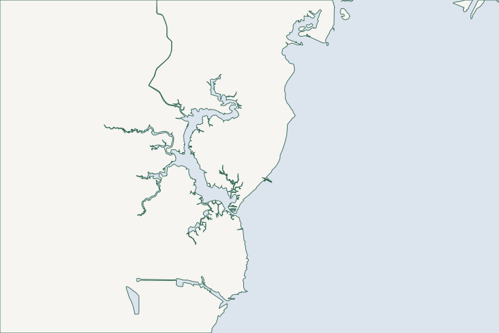
Dog River, Halls Mill & Rabbit Creek at a glance
- Who permits it
- Build Mobile on the city side; Mobile County Inspection Services on the unincorporated side
- Call first
- Build Mobile, (251) 208-5895
- The water
- Dog River Bridge gauge peaked 4.60 ft above MHHW in Nate and fell 5.58 ft below it in Sally
- Local rule to know
- City permits wait on proof of federal and state permits, and the river mouth is roughly unincorporated county land, so confirm by parcel number
Get to know your waterfront
Census maps put most of Dog River in the City of Mobile. Roughly the river mouth, Rabbit Creek and Alligator Bayou are unincorporated county land. The daily tide is small. Surge in Nate and Zeta and the Sally drawdown are what test a wall here.
TIGERweb Places, layer 4 (Incorporated Places), point-in-polygon tests at USGS GNIS stream-mouth coordinates · CO-OPS Data API, water_level, Dog River Bridge 8735391 (queried for Zeta, Nate and Francine windows) · CO-OPS Data API, water_level, Dog River Bridge, Chickasaw Creek and Coast Guard Sector Mobile (September 15-17, 2020)
The city and county line, the gauge record and your launch options
A Dog River owner has two possible permit desks and one narrow river. Sort out the desk first, then the wall.
Is my Dog River lot in the city or the county?
Census city boundaries, queried in November 2026, put most of the river in the City of Mobile. They are a map layer, not a ruling on your parcel. That includes the upper river and the mouths of Halls Mill Creek, Moore Creek, Robinson Bayou, Spring Creek, Bolton Branch, Eslava Creek, Rattlesnake Bayou and Perch Creek. Census city boundaries
Roughly a pocket along the lower river's south and west side is unincorporated. It takes in the mouths of Rabbit Creek and Alligator Bayou, the river mouth itself and Hollinger's Island. Census city boundaries
| Parcel location | Office | Phone |
|---|---|---|
City side, such as Halls Mill Creek | Build Mobile | (251) 208-5895 |
County side, such as Rabbit Creek | Mobile County Inspection Services | (251) 574-3507 |
County land question | County Engineering, development desk | (251) 574-8595 |
The line runs roughly there, so lots near it need care. The owner confirms the side with the parcel number before paying for drawings. The Revenue Commission at (251) 574-8530 runs the parcel search, and the Mobile County permit guide covers records. County records
What does the city want for a Dog River bulkhead?
On a lot in a V, A or shaded X zone, the city asks for a Flood Zone Development Permit signed by both owner and contractor. Mobile flood permit form
The simple Single Family Residential Affidavit works only if no fill goes into a flood zone and under 4,000 square feet is disturbed. Backfill behind a new wall can push the job to a larger land disturbance permit. Land Disturbance Guide
Filling in a flood zone needs an engineer's no-rise certificate, which shows cut and fill balance. Land Disturbance Guide
- Water quality is a stated priority for the Dog River watershed, so silt control matters. The city lets bare soil stand for no more than 10 days. Land Disturbance Guide MBNEP watershed page
- Minor residential excavation under 4,000 square feet and 2 feet deep may be exempt, but clearing in a flood hazard area never is. City Code Sec. 17-8
What does the county ask on the unincorporated side?
County Engineering says there is no zoning in unincorporated Mobile County, and you can request written confirmation by parcel number. County Engineering
- Almost any work needs a county permit, and a flood-zone lot needs an Elevation Certificate or a waiver. Plan review takes 5 to 10 working days. County permit checklist
- Any development in a special flood hazard area needs a county Permit to Develop. Fill in an A zone must not raise the base flood by more than one foot. County stormwater plan
- Working without a permit doubles the fee on a first offense. County fee schedule
Ask whether a bulkhead falls under the county's base fee plus 0.5 percent of contract cost, and get the answer in writing. County fee schedule
How high does Dog River rise, and how low does it drop?
The Dog River Bridge gauge (8735391) has run since 2010 and shows a great diurnal tide range of 1.64 feet. NWS flood steps there are 2, 3 and 6 feet above mean higher high water. NOAA gauge 8735391
- Nate in 2017 peaked at 4.60 feet and Zeta in 2020 at 4.38 feet, both past the moderate step. NOAA 6-minute data
- Isaac in 2012 reached 3.83 feet, and Ida in 2021 reached 3.36 feet. CO-OPS top ten list
- Francine in 2024 reached only 2.49 feet. NOAA 6-minute data
- Sally's north wind dropped the river 5.58 feet below mean higher high water on September 16, 2020. NOAA Sally readings
Mapped flood levels run VE 13 to 14 feet near the mouth and AE 10 to 12 feet up the river. FEMA flood map Isaac flooded Dauphin Island Parkway at the bridge, and Ida closed the foot of the bridge. NWS Isaac summary NWS Ida summary
How big is the river, and how much of it has a wall?
Dog River is about 7 miles long with 127 miles of shoreline, counting creeks, and it drains 95 square miles of mostly city land. Dog River Clearwater Revival
The Geological Survey of Alabama mapped 31.7 percent of the Dog River system as hard armor in 2011. Living Shorelines Policies Manual
In 2003 a Dog River site beat boat wake erosion with a timber wave fence, leeward sand and marsh plants. Living Shorelines Policies Manual See the riprap and shoreline stabilization page for options.
Where are the launches, marinas and the bridge limit?
The fixed State Route 163 bridge at the mouth clears 73 feet, and a marked channel runs in from the bay. A railroad bridge 7 miles up clears 8 feet. Coast Pilot 5
Several small-craft facilities offer berths and lifts to 70 tons. Many small landings along the bay's west shore are in ruins. Coast Pilot 5 The maintained channel depth is 7 feet. Shoreline Management Plan
- The Dog River Scenic Blueway lists launches at Dog River Park, Schwartz Park on Halls Mill Creek, Gulfdale on Robinson Bayou and McNally Park on Perch Creek. Dog River Clearwater Revival
- Dog River Park, 2459 N. Dog River Drive, has a boat ramp and kayak launch, (251) 208-1600. Mobile Parks and Recreation
- As of June 2026, the city plans a Halls Mill Creek launch at Shipyard Road, built after rail crossing work. It lists $2 million in state money and about $1 million in city funds. Fox 10, June 23, 2026
- In 2018 the RESTORE Council gave the city over $3.5 million for the Perch Creek area. NBC 15
Which state and federal steps come first?
The city will not issue its permits until you show the federal and state ones. City Code Sec. 17-6 See the permit overview for the Corps, ADEM and State Lands path.
Check the neighbours at Mobile's bay front and Hollinger's Island and Deer River.
What could the work cost?
Local bids do not publish a per-foot price for a Dog River wall. The 2014 MBNEP guide gives installed wood at $115 to $180 per foot and sheet pile at $500 to $1,000. Add engineering for the flood-zone paperwork and silt control.
Prices below are published figures, not a quote for your wall. Local figures come from Baldwin County bid tables and a 2014 Mobile Bay guide. National guides and contractor pages fill the gaps, and each row says which one it is.
Compare quotes and plan a budget →Find the relevant permits and records
| Starting point | What to resolve | Prepare and look up |
|---|---|---|
Build Mobile, (251) 208-5895 | City-side lots on Halls Mill Creek, Moore Creek and Robinson Bayou | Street ticket, signed development permit application, land disturbance permit, then a building permit through the online portal. |
Mobile County Inspection Services, (251) 574-3507 | County-side lots at the river mouth, Rabbit Creek and Alligator Bayou | Elevation Certificate or waiver, contract on letterhead, and the flood-zone Permit to Develop. |
County Engineering, (251) 574-8595 | Proof that a county parcel has no zoning | Send the parcel or key number to ask for written confirmation. |
Corps of Engineers, (251) 690-2658 | Federal permit request for work in tidal water | Request through the Corps' online system. Also contact ADEM, (251) 304-1176, and State Lands. |
State Lands, (251) 621-1216 | Consent of Use for riprap and wall placement | Replacement walls may sit up to 2 feet waterward of high tide; new ones go at or landward of it. |
Sorting out your Dog River parcel
Do these in order and the right office will answer.
Check the line on the county map
Look up your parcel number and ask which office covers it. The Census city line only points the way: creek mouths and the river mouth fall on opposite sides.
Get the flood zone in writing
Expect VE 13 to 14 near the mouth and AE 10 to 12 farther up.
National Flood Hazard Layer, layer 28 (flood hazard zones), envelope query
Test the toe at low water
Sally's drawdown shows how deep the wall's toe really sits.
Plan erosion control now
Water quality is a watershed priority, and the city's 10-day bare-soil limit will apply to your site.
Land Disturbance (L.D.) Permit Guide · Dog River Watershed | Mobile Bay National Estuary Program
Get a local contractor to look
Send your creek, your street and what the wall is doing. A local marine contractor will reach out and help you find the right permit desk.
Each page draws on Mobile Bay permit offices, local ordinances, public bids, tide gauges and storm reports.
Dog River, Halls Mill & Rabbit Creek project questions
Who permits a bulkhead on Rabbit Creek?
Census maps put Rabbit Creek's mouth roughly on the unincorporated side, so start with Mobile County Inspection Services at (251) 574-3507. Halls Mill Creek's mouth is roughly in the city. Confirm either with your parcel number.
TIGERweb Places, layer 4 (Incorporated Places), point-in-polygon tests at USGS GNIS stream-mouth coordinates · Inspection Services
Is Dog River tidal enough to flood from the bay?
Yes, though the daily range is only 1.64 feet. Nate pushed the gauge 4.60 feet above mean higher high water, and Zeta pushed it 4.38 feet.
CO-OPS Metadata API: Dog River Bridge 8735391 datums and flood levels · CO-OPS Data API, water_level, Dog River Bridge 8735391 (queried for Zeta, Nate and Francine windows)
What happened on Dog River in Hurricane Sally?
The water drained out. The Dog River Bridge gauge fell 5.58 feet below mean higher high water, and its highest Sally reading was just 1.99 feet above it.
Can a tall boat get under the Dog River bridge?
The State Route 163 bridge at the river mouth is fixed and has 73 feet of clearance. A railroad bridge about 7 miles up has only 8 feet.
Where can I launch a kayak on Halls Mill Creek?
Schwartz Park is a listed Blueway launch. As of June 2026 the city planned a new launch at Shipyard Road, to follow a rail crossing upgrade.
Dog River Scenic Blueway | Dog River Clearwater Revival · Coming soon to Halls Mill Creek: a boat launch and improved railroad crossing
Keep planning
Nearby waterfront guides
Mobile's bay front, Arlington & Brookley, Hollinger's Island, Belle Fontaine & Deer River, Chickasaw Creek, Bayou Sara & the upper river
Show sourcesHide sources
- TIGERweb Places, layer 4 (Incorporated Places), point-in-polygon tests at USGS GNIS stream-mouth coordinatesSource reviewed 2026-11-04
- CO-OPS Data API, water_level, Dog River Bridge 8735391 (queried for Zeta, Nate and Francine windows)Source reviewed 2026-11-04
- CO-OPS Data API, water_level, Dog River Bridge, Chickasaw Creek and Coast Guard Sector Mobile (September 15-17, 2020)Source reviewed 2026-11-04
- Permitting | Build MobileSource reviewed 2026-11-04
- Inspection ServicesSource reviewed 2026-11-04
- Development and ZoningSource reviewed 2026-11-04
- Mobile County Revenue Commission; Probate Court Records SearchSource reviewed 2026-11-04
- Development Permit Application for all properties in V-Zones, A-Zones and X-Shaded (rev. December 2022)Source reviewed 2026-11-04
- Single Family Residential Affidavit (SFRA) application and guide (rev. 3-13-25)Source reviewed 2026-11-04
- Land Disturbance (L.D.) Permit GuideSource reviewed 2026-11-04
- Dog River Watershed | Mobile Bay National Estuary ProgramSource reviewed 2026-11-04
- Mobile City Code Chapter 17, Secs. 17-6 and 17-8Source reviewed 2026-11-04
- Mobile County Building Inspections - Information required for obtaining a building permit (7-1-26)Source reviewed 2026-11-04
- Mobile County Storm Water Management Program Plan (December 2017), Appendices D and ESource reviewed 2026-11-04
- Exhibit A, Mobile County Alabama - Building Permit Fees, Effective July 1, 2026 (page 2)Source reviewed 2026-11-04
- CO-OPS Metadata API: Dog River Bridge 8735391 datums and flood levelsSource reviewed 2026-11-04
- CO-OPS top ten water levels, Dog River Bridge 8735391Source reviewed 2026-11-04
- National Flood Hazard Layer, layer 28 (flood hazard zones), envelope querySource reviewed 2026-11-04
- NWS Mobile: Hurricane IsaacSource reviewed 2026-11-04
- NWS Mobile: Hurricane Ida (August 2021)Source reviewed 2026-11-04
- Our Urban Watershed | Dog River Clearwater RevivalSource reviewed 2026-11-04
- Coastal Alabama Living Shorelines Policies Manual (Table 3)Source reviewed 2026-11-04
- U.S. Coast Pilot 5, Chapter 7 (Mobile Bay)Source reviewed 2026-11-04
- Mobile County Shoreline Management Plan (December 2025), Section 6.2 and Tables 20-22Source reviewed 2026-11-04
- Dog River Scenic Blueway | Dog River Clearwater RevivalSource reviewed 2026-11-04
- Dog River Park | City of MobileSource reviewed 2026-11-04
- Coming soon to Halls Mill Creek: a boat launch and improved railroad crossingSource reviewed 2026-11-04
- City of Mobile awarded $3.5 million to revive Perch CreekSource reviewed 2026-11-04
- City of Mobile Residential Plan Review Application (rev. November 2026)Source reviewed 2026-11-04
- South Atlantic Division > Missions > Regulatory > AlabamaSource reviewed 2026-10-31
- Alabama Coastal Area Management Program (ADEM Coastal Program page)Source reviewed 2026-10-31
- Contact Us (Alabama Department of Conservation and Natural Resources)Source reviewed 2026-10-31
- ADCNR Admin. Code r. 220-4-.09 Placement and Configuration of Piers and Other Improvements on State Owned Submerged LandsSource reviewed 2026-10-31
- Living Shorelines: A Guide for Alabama Property Owners (Cost Guide, section 4)Source reviewed 2026-11-04