
Dauphin Island West End: Gulf-Front Seawall Ban and Options
A Dauphin Island seawall on the Gulf front is not allowed. Town zoning bans seawalls, retaining walls and riprap there, so west end owners need other tools.
Describe your project on this page ↓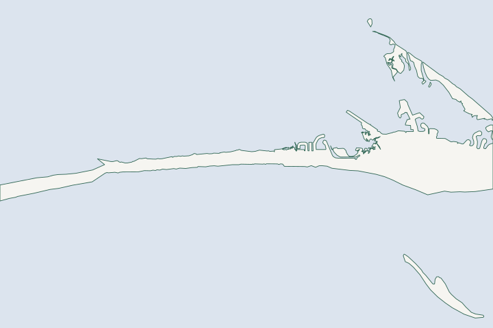
Dauphin Island west end & Gulf front at a glance
- Who permits it
- The Town of Dauphin Island, as ADEM's delegate on the Gulf front
- Call first
- Town Hall, building inspector, (251) 861-5525 ext. 229
- The water
- The Gulf shore retreated about 260 feet on average from 1957 to 2022
- Local rule to know
- Seawalls, retaining walls and riprap are banned on the Gulf front
Get to know your waterfront
On the Gulf front of Dauphin Island, Town zoning bans seawalls, retaining walls and riprap between the East Bastion of Fort Gaines and the western tip. Owners protect a house by elevating it, keeping the dune intact and joining the public sand project. That project would place 2.565 million cubic yards of sand along 3.5 miles, with $38 million approved in the Council's 2026 funding list. The Town plans to start construction in winter 2027.
Town of Dauphin Island Zoning Ordinance No. 105, section 7.14 (Seawall Requirements & Regulations) · Attachment A: Expanded Responses to USACE/ADEM Joint Permit Application SAM-2024-00553 · Finding of No Significant Impact: West End Dauphin Island, Alabama Renourishment and Resilience - Implementation · West End Nourishment Project | Town of Dauphin Island
The seawall ban, the sand project and what owners can do
Short version: do not plan a wall. Plan an elevation, a walkover and an easement signature.
Can you build a Dauphin Island seawall on the Gulf front?
No. Section 7.14 of Zoning Ordinance 105 says no seawalls, retaining walls or similar devices, including riprap, may be built on Gulf-fronting beaches and adjacent lands in the Town. Seawall Ordinance 106 covers the Gulf side between the East Bastion of Fort Gaines and the western tip. Zoning Ordinance 105, section 7.14
The Coastal Construction Line adds a second barrier. ADEM surveyed it, and the Town is a delegated entity bound by ADEM's rules. Zoning Ordinance 105, section 7.13
- On the Gulf side, nothing may be built in the strip from mean high tide inland to that line.
- Between the west end and the East Bastion, no structure may stand within 200 feet south of mean high tide.
- A structure damaged or destroyed more than 50 percent must be removed. Zoning Ordinance 105, section 7.13
State rules agree. ADEM treats walls on Gulf beaches as not permissible unless the wall sits landward of the line, protects an existing structure, and no non-structural option works. ADEM beach rule ADEM defines the line as straight segments between coordinates near survey monuments DI-16 through DI-33. ADEM definition, Mobile County
Zoning points to a separate seawall ordinance, No. 106, and the Town posts its ordinances as PDFs rather than on Municode. Ask Town Hall for the current text and any exceptions before you assume anything. Town ordinance list
What is the West End beach and dune project?
It is a public sand fill and dune build. Its permit file is SAM-2024-00553, and it follows a shore where the beach south of the houses is gone along most of the West End. Permit application, January 2025
| Item | Figure |
|---|---|
Length | About 3.5 miles of Gulf shore |
Sand | 2,565,000 cubic yards over 202.4 acres |
Permit approved | December 8, 2025 |
Funding | $38 million, approved in the 2026 funding list |
Sources: Town permit application, RESTORE Council. Permit application RESTORE Council approval
The Council signed a Finding of No Significant Impact on June 16, 2026. RESTORE Council approval The sand comes from offshore borrow areas about 4 miles out, and the Town says no pits will be dug on the island. Town sand source page
When will the sand arrive?
The Town's own page, viewed November 4, 2026, gives this plan. Dates can slip.
- Owner easements are being collected from May through December 2026.
- Final design and bidding are planned for fall 2026.
- Construction is planned to start in winter 2027.
- The Town expects sand and dune work to take 4 to 6 months, then about 30 days of planting.
- Monitoring is planned for 3 years. Town West End page
What do the easement and the mean high tide line mean for owners?
If you do not sign the easement, you get no sand. The Town asks for construction and monitoring easements, reaching about the +5-foot contour or the existing porches and pilings. They let it place sand on private lots at no charge. Town easement terms
The Town wants every lot in the footprint to take part, since a skipped lot would sit low and could hold water. Town easement terms
The engineered beach also becomes eligible for FEMA claims after declared storms, and the Town is responsible for upkeep. Beach Act line, Town documents
The new dune will stand about 10 feet above the beach. Since summer 2025 it sits just south of the designated line. So Gulf-front owners will need walkovers or dune gaps to reach the sand. Who builds and pays for private walkovers is not yet set. Town FAQ
What can a Gulf-front owner do instead of a wall?
- Elevate. Flood protection height is base flood elevation plus 2 feet. The island has required that extra 2 feet since Katrina. Zoning Ordinance 105, freeboard
- Use deep piles. FEMA credits the Town's 10-foot minimum pile depth. Structures built to NFIP standards averaged about $3,000 per claim in three major hurricanes, against nearly $12,000 for older ones. FEMA case study
- Build a walkover, not a path. Each single-family home may have its own. Slats are spaced 1/2 inch apart, and piers are hand-augered at least 3 feet deep, not set in cement. Town walkover standards
- Time the work. No walkover may be built between May 1 and November 1, during sea turtle nesting. Owners who will not cross the dune must post sand fencing and "no crossing" signs. Town West End application
The West End Overlay lets the Town set setbacks case by case for R-1 "through lots" because the shore erodes or builds. South of Bienville Boulevard the back setback stays at least 10 feet from the right-of-way line. North-side houses must sit within 200 feet of the north right-of-way, or 150 on Bridgeview Drive and 100 on Island Shores Drive. West End Overlay
What is Katrina Cut?
It is the old breach at the island's far western end. USGS describes it as intermittent and about 1.35 kilometers long after Ivan in 2004. After Katrina in 2005 it was continuous and over 2 kilometers long. A rubble mound closed it in 2010. USGS breach history
In USGS modeling, a sand berm in place of that mound eroded completely, and the simulated breach reached about 3.5 kilometers wide. USGS modeling The West End project runs west to the east end of that closure. Permit application
Why has this shore lost so much ground?
The shore retreated 200 to 300 feet in the 1915 to 1930s hurricane period. From 1957 to 2022 it averaged 260 feet along the West End beaches. The sandy beach and dune south of houses in the 1990s are gone along most of the West End. Town West End FAQ
Most sand lost south of Bienville Boulevard went north by overwash in major storms. 2024 design report
- Georges in 1998 pushed Gulf-front west-end homes across the island and breached it in several places. NWS Georges
- Katrina put the west end under water and washed away most homes there. NWS Katrina
FEMA says 8 miles on the western side have no development. Town and FEMA
Bay-side lots on the island follow different rules. See Dauphin Island bay side. For general erosion background, read the shoreline erosion guide and the storm guide. County-wide permit contacts are in the Mobile County permit guide.
What could the work cost?
There is no per-foot wall price to give on the Gulf front, because walls are banned. The public cost is the sand project: $38 million approved in the 2026 funding list, against a March 2024 estimate of about $46 million. Easements cost owners nothing, but elevation and walkovers do.
Prices below are published figures, not a quote for your wall. Local figures come from Baldwin County bid tables and a 2014 Mobile Bay guide. National guides and contractor pages fill the gaps, and each row says which one it is.
Compare quotes and plan a budget →Find the relevant permits and records
| Starting point | What to resolve | Prepare and look up |
|---|---|---|
Dauphin Island Building Department | Gulf-front building permit, Citizenserve portal | Have your contract and cost list ready. Call (251) 861-5525: inspector ext. 229, permit clerk ext. 223. |
Town Coastal Use Permit | Work near dunes, floodplain or water | Fee is $100. Check flood zone, dunes and species before you apply. |
Town as ADEM delegate (Gulf front) | Beach and dune rule, Coastal Construction Line | A survey showing the line from the ADEM monuments. Walls are banned by Town zoning. |
Town Building Official, flood review | Special Flood Hazard Overlay work | Flood zone (AE, VE or X) and a plan that adds 2 feet of freeboard. |
Town West End project, easement desk | Sand placement on your lot | Read the easement terms. The Town is collecting easements through December 2026. |
Steps for a Gulf-front owner on the west end
Start here before you pay for a design.
Call Town Hall and ask for the inspector
Ask which rule covers your lot, and whether the seawall ordinance has any exception.
Building Department | Town of Dauphin Island · Municode Library: Alabama (municipality list)
Order a survey that shows the line
The survey must tie the Coastal Construction Line to the ADEM state-plane monuments.
Check your flood zone and freeboard
AE, VE or X decides which standards apply. Plan 2 feet above base flood elevation.
Town of Dauphin Island Zoning Ordinance No. 105, section 4.11.5 (SFHOD) · Town of Dauphin Island Zoning Ordinance No. 105, Article 2 definitions (Flood Protection Elevation; Freeboard)
Decide on the easement soon
The Town's page says easements are collected through December 2026. No signature means no sand on your lot.
Plan your west end next step
Tell us your street, whether you front the Gulf, and what you want to protect. Call to talk it through, or send the details and a local professional can follow up.
Each page draws on Mobile Bay permit offices, local ordinances, public bids, tide gauges and storm reports.
Dauphin Island west end & Gulf front project questions
Are seawalls allowed on the Gulf side of Dauphin Island?
No. Zoning Ordinance 105 bans seawalls, retaining walls and riprap on Gulf-fronting beaches and adjacent lands. Zoning refers to a separate seawall ordinance, so ask Town Hall for its text and any exceptions.
Town of Dauphin Island Zoning Ordinance No. 105, section 7.14 (Seawall Requirements & Regulations) · Municode Library: Alabama (municipality list)
How big is the West End beach and dune project?
It covers about 3.5 miles of Gulf shore and 2,565,000 cubic yards of sand. The permit was approved December 8, 2025, and the RESTORE Council approved $38 million in its 2026 funding list.
Attachment A: Expanded Responses to USACE/ADEM Joint Permit Application SAM-2024-00553 · Finding of No Significant Impact: West End Dauphin Island, Alabama Renourishment and Resilience - Implementation
Do I have to sign the West End easement?
No one has to, but owners who do not sign get no sand. The easement is free and lets the Town place sand and return for surveys and minor upkeep. The Town is collecting signatures through December 2026.
When can I build a dune walkover?
Not between May 1 and November 1, when sea turtles nest. Each single-family home may have one walkover, built to the Town's standards.
Attachment A: Expanded Responses, USACE/ADEM Joint Permit Application SAM-2024-00553 (West End Beach & Dune Restoration) · Article 10: Dune Protection Overlay District (DPOD) Requirements, section 9
Keep planning
Nearby waterfront guides
Dauphin Island bay side & Aloe Bay, Bayou La Batre & Portersville Bay, Coden, Heron Bay & Cedar Point
Show sourcesHide sources
- Town of Dauphin Island Zoning Ordinance No. 105, section 7.14 (Seawall Requirements & Regulations)Source reviewed 2026-11-04
- Attachment A: Expanded Responses to USACE/ADEM Joint Permit Application SAM-2024-00553Source reviewed 2026-11-04
- Finding of No Significant Impact: West End Dauphin Island, Alabama Renourishment and Resilience - ImplementationSource reviewed 2026-11-04
- West End Nourishment Project | Town of Dauphin IslandSource reviewed 2026-11-04
- ADEM Admin. Code Chapter 335-8-2, rule 335-8-2-.08 Construction and Other Activities on Gulf Front Beaches and DunesSource reviewed 2026-10-31
- Alabama Administrative Code 335-8-1-.02 (definitions)Source reviewed 2026-11-04
- Municode Library: Alabama (municipality list)Source reviewed 2026-11-04
- Frequently Asked Questions: Dauphin Island West End Beach and Dune Restoration ProjectSource reviewed 2026-11-04
- Dauphin Island West End Nourishment Project: Public Hearing per Alabama Code 9-15-56 (December 11, 2024)Source reviewed 2026-11-04
- Dauphin Island NFIP ComplianceSource reviewed 2026-11-04
- Article 10: Dune Protection Overlay District (DPOD) Requirements, section 9Source reviewed 2026-11-04
- Island breaching, Dauphin Island, AlabamaSource reviewed 2026-11-04
- Application of Decadal Modeling Approach to Forecast Barrier Island Evolution, Dauphin Island, Alabama (OFR 2020-1001)Source reviewed 2026-11-04
- Attachment C: Preliminary Design Phase Report, West End Beach and Dune RestorationSource reviewed 2026-11-04
- NWS Mobile: Hurricane GeorgesSource reviewed 2026-11-04
- NWS Mobile: Hurricane Katrina storm surge and impactsSource reviewed 2026-11-04
- West End Nature Preserve | Town of Dauphin IslandSource reviewed 2026-11-04
- Building Department | Town of Dauphin IslandSource reviewed 2026-11-04
- Business Licenses & Permits | Town of Dauphin IslandSource reviewed 2026-11-04
- Appendix B: Schedule of Fees (Planning Commission and permit fees)Source reviewed 2026-11-04
- Coastal Permitting InformationSource reviewed 2026-10-31