
Causeway Bulkhead and Delta Dock Help, Spanish Fort AL
Bulkhead repair on the Causeway means building on a 1927 road fill beside the Mobile-Tensaw Delta. This guide covers who permits the work, what the fill changes and where the Delta rivers add limits.
Describe your project on this page ↓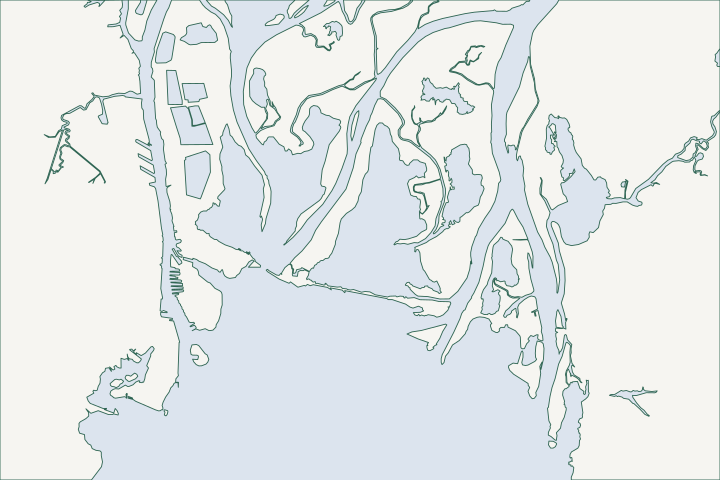
The Causeway & Mobile-Tensaw Delta at a glance
- Who permits it
- Spanish Fort Building Official for most Causeway lots, plus state water agencies
- Call first
- City of Spanish Fort Building Official, (251) 626-4993
- The water
- Causeway fill beside the Delta; fixed bridges clear 16 feet on the Blakeley
- Local rule to know
- Coastal permit and erosion control plan below 10 feet in Spanish Fort
Get to know your waterfront
A Causeway bulkhead sits on dredged fill beside a state highway. Most lots are inside Spanish Fort, so the city, the highway department and three water agencies can all have a say. Past the road, the Delta rivers add bridge limits for any barge. Start by confirming which city owns your lot.
Restoration of Hydrology along Upper Mobile Bay Causeway: Feasibility Investigation Report (Weston Solutions for ADCNR State Lands Division, December 2015) · TIGERweb Census Current (2026) Incorporated Places (layer 28) and Counties (layer 82), point-in-polygon and boundary queries · Zoning Ordinance, City of Spanish Fort, Alabama (Ordinance No. 51-96, as amended) · U.S. Coast Pilot 5, Chapter 7
Causeway lots and Delta camps: what to check before the wall
The short answer is that a Causeway lot has more owners of the surrounding ground than most bay lots. The road, the fill, the water bottom and the city line each belong to someone different. Sort those out first, then price the wall.
Who permits work on a Causeway lot?
Most of the Causeway lies inside the City of Spanish Fort. A piece near the east end falls in Daphne. West of the county line, the Causeway is in Mobile County. Census boundary layers
Inside Spanish Fort, the Building Official runs a coastal development permit for lots under the 10 foot elevation mark. The application needs an erosion control plan. Spanish Fort Zoning Ordinance Article IX Call the department at (251) 626-4993 to ask what to file for a pier or bulkhead. Spanish Fort Building Department
The highway is a separate matter. US 90/98, called Battleship Parkway here, is a state road.
As of August 2026, the state highway department was replacing the westbound Tensaw River span in a project of roughly $79 million. Seawall and approach work was under way, with completion expected by mid-2028. Construction Equipment Guide No public rule for private structures at the highway edge turned up, so ask the department in writing if your wall runs close to the pavement.
On the water side, the Corps of Engineers, ADEM and the State Lands Division all review the job. State Lands handles the bottoms under the water. Its Spanish Fort coastal office answers at (251) 621-1216. ADCNR contact page The Alabama permit guide walks through the order of those filings.
What does 1927 fill mean for a bulkhead?
The Causeway was built in 1927 by filling open water and marsh with dredged material for the roadbed. Water now passes between the Delta and the bay mainly through four narrow gaps in the road. ADCNR Causeway report, 2015
That history has three practical effects for a lot owner.
- Fill settles unevenly, so a wall can lean or lose soil behind the cap even when the sheet pile is sound.
- A state study measured DDT compounds, PAHs and metals over ecological benchmarks in the mud on both sides. The most excess readings were at Shellbank River. ADCNR Causeway report, 2015
- Dredged or imported fill must be free of toxic pollutants and sludge, and ADEM bars dredging near grass beds and oyster reefs. ADEM coastal rules
Before driving piles or digging a slip, ask the contractor and State Lands whether sampling is needed. That study also weighed new road gaps at Choccolatta Bay, at Justins Bay and at the Shellbank River. A lot near one of those sites should check with State Lands before the design is fixed. ADCNR Causeway report, 2015
How have storms treated the Causeway?
The Causeway floods first and often. Georges in 1998 pushed the surge to 8.0 feet above mean sea level along the road, and many businesses were damaged. National Weather Service Mobile Katrina damaged or destroyed most Causeway businesses in 2005. National Weather Service Mobile
Zeta in 2020 flooded the whole roadway. Surveyors measured 7 to 9 feet of water in northeast Mobile Bay, from the Causeway and Delta south to Fairhope. National Weather Service Mobile Nate in 2017 pushed its highest surge along the Eastern Shore and north into the Delta. National Weather Service Mobile
Smaller events matter too. Tropical Storm Bertha closed the eastbound lanes for about five hours in July 2026. National Weather Service Mobile The tide station at Meaher State Park, number 8733839, lists a great diurnal range (the usual high-to-low swing) of about 1.5 feet. NOAA tide stations
Which Delta limits apply to barges and boats?
North of the road, the Mobile-Tensaw Delta is about 45 miles long and about 300 square miles in all. Encyclopedia of Alabama Bridges set the size of any barge you can bring up a river.
| River | Crossing | Clearance |
|---|---|---|
Blakeley and Apalachee | Twin bridges at the mouths | 16 feet |
Tensaw | US 90 bridges at the mouth | 26 feet |
Tensaw | Twin bridges 0.3 mile north | 24 feet |
Tensaw | Power cable just north | 46 feet |
Sources: Coast Pilot 5 Coast Pilot 5
Staging points matter as much as clearance. Meaher State Park has a boat ramp on the Blakeley River, a $5 launch fee and a 300-foot fishing pier. Alabama State Parks Live Oak Landing at Stockton has six ramps and free launching outside tournaments. Baldwin County
No rule written only for Delta fishing camps turned up. A camp on a river bank still needs the same Corps, ADEM and State Lands review as any other wall or pier. See the dock and boat lift service page for the pier steps.
Which public projects are changing the Causeway shore?
Public money is rebuilding parts of the shore with rock instead of vertical wall. Valor Park, a two-acre park between the battleship and Felix's Fish Camp, broke ground in February 2026, with riprap going in for a natural shoreline feature. Fox 10 said it expected the park to open by the end of that summer. Fox 10, 2023 and 2026
- The mayor put the cost of Spanish Fort's 2018 Causeway Master Plan at about $20 to $24 million, built as grants arrive. WPMI
- The state's July 2023 GOMESA award list included $650,000 for a Chocolatta Bay boat ramp replacement on the Causeway. WBRC GOMESA list
- The 5 Rivers conservation center on the Causeway reopened in April 2026 after a year of upgrades. ADCNR
If you want softer edges on your own lot, read the living shoreline guide and the riprap service page. For the city's bluff homes south of the road, see Spanish Fort and D'Olive Bay.
What could the work cost?
Causeway jobs can cost more than a bay lot of the same length because of soft fill, limited barge access and sediment questions. Ask each bidder how it plans to handle settlement, spoil and the water-side permits.
Prices below are published figures, not a quote for your wall. Local figures come from Baldwin County bid tables and a 2014 Mobile Bay guide. National guides and contractor pages fill the gaps, and each row says which one it is.
Compare quotes and plan a budget →Find the relevant permits and records
| Starting point | What to resolve | Prepare and look up |
|---|---|---|
Spanish Fort Building Department | Coastal permit for lots below 10 feet in the city | Erosion control plan, site survey and a call before filing, (251) 626-4993 |
State highway department (ALDOT) | Anything at or near the US 90/98 right of way | A written question with a survey showing the wall and the pavement edge |
Corps of Engineers Mobile District | Any work in or over tidal water | Online Corps request, plus drawings of the high and low water lines, (251) 690-2658 |
ADEM Coastal Program | Coastal program review of walls, piers and fill | Copy of the joint filing and proof of no wetland fill, (251) 304-1176 |
ADCNR State Lands Division | State-owned bottom under tidal water | Request form for state submerged lands plus your deed or lease, (251) 621-1216 |
Four steps before you call a marine contractor
Check the ground and the water in this order.
Confirm the city line
Most of the Causeway is Spanish Fort, but a stretch near the east end is Daphne.
Call the Building Department
Ask what Spanish Fort wants for a coastal permit and an erosion control plan.
Zoning Ordinance, City of Spanish Fort, Alabama (Ordinance No. 51-96, as amended) · BUILDING DEPARTMENT | City of Spanish Fort
Ask State Lands about the bottom
Find out whether the water bottom is state owned and whether sediment sampling applies.
ADCNR Admin. Code Chapter 220-4 (State Lands Division), r. 220-4-.09 Placement and Configuration of Piers and Other Improvements on State Owned Submerged Lands · Restoration of Hydrology along Upper Mobile Bay Causeway: Feasibility Investigation Report (Weston Solutions for ADCNR State Lands Division, December 2015)
Plan the barge route
Match barge height to the 16 foot Delta bridges before you accept a bid.
Talk through a Causeway or Delta lot
Send the address, the water body and what is failing. A local marine contractor can look at fill, access and permits with you.
Each page draws on Mobile Bay permit offices, local ordinances, public bids, tide gauges and storm reports.
The Causeway & Mobile-Tensaw Delta project questions
Is a Causeway lot in Spanish Fort or Daphne?
Most of the Causeway is inside Spanish Fort. A short stretch at the east end belongs to Daphne. West of the county line, it is Mobile County. Check the parcel map before you call a building office.
Why is Causeway fill a problem for a bulkhead?
The road sits on dredged material placed in 1927, and soil behind a wall can settle unevenly. A state study also reported old pollutants in the mud on either side, so ask about sampling before digging.
How tall can a barge be on the Delta rivers?
Under 16 feet at the fixed bridges on the Blakeley and Apalachee. The Tensaw bridges clear 24 to 26 feet. Confirm the water level on the day of the move.
U.S. Coast Pilot 5, Chapter 7 · U.S. Coast Pilot 5, Chapter 7 (Gulf Coast: Mobile Bay to Mississippi River)
How high did water get on the Causeway in Zeta?
Surveyors measured 7 to 9 feet of water in northeast Mobile Bay from the Causeway and Delta south to Fairhope. The road was completely flooded.
Is there a special rule for Delta fishing camps?
No camp-specific rule turned up in public sources. Camps follow the same Corps, ADEM and State Lands steps as other waterfront structures. Ask the agencies about your exact river bank.
ADEM Form 166, Joint Application and Notification, U.S. Department of Army Corps of Engineers / Alabama Department of Environmental Management (rev. 8/19) · Contact Us (Alabama Department of Conservation and Natural Resources)
Keep planning
Nearby waterfront guides
Show sourcesHide sources
- Restoration of Hydrology along Upper Mobile Bay Causeway: Feasibility Investigation Report (Weston Solutions for ADCNR State Lands Division, December 2015)Source reviewed 2026-10-31
- TIGERweb Census Current (2026) Incorporated Places (layer 28) and Counties (layer 82), point-in-polygon and boundary queriesSource reviewed 2026-10-31
- Zoning Ordinance, City of Spanish Fort, Alabama (Ordinance No. 51-96, as amended)Source reviewed 2026-11-04
- U.S. Coast Pilot 5, Chapter 7Source reviewed 2026-11-04
- BUILDING DEPARTMENT | City of Spanish FortSource reviewed 2026-10-31
- Tensaw River Bridge Replacement Will Strengthen CorridorSource reviewed 2026-11-04
- Contact Us (Alabama Department of Conservation and Natural Resources)Source reviewed 2026-10-31
- ADEM Admin. Code Chapter 335-8-2, rule 335-8-2-.02 Dredging and/or FillingSource reviewed 2026-10-31
- Hurricane Georges - September 28, 1998Source reviewed 2026-11-04
- Hurricane Katrina - August 2005Source reviewed 2026-11-04
- NWS Mobile: Hurricane ZetaSource reviewed 2026-11-04
- Hurricane Nate - October 7-8, 2017Source reviewed 2026-11-04
- County Impacts Associated with Tropical Storm Bertha (2026)Source reviewed 2026-10-31
- CO-OPS datums: 8733821 Point Clear, 8733502 Fly Creek, 8733839 Meaher State Park, 8732828 Weeks BaySource reviewed 2026-10-31
- Mobile-Tensaw DeltaSource reviewed 2026-11-04
- Meaher State ParkSource reviewed 2026-11-04
- Live Oak Landing - Baldwin County Boat LaunchesSource reviewed 2026-11-05
- Spanish Fort breaks ground on Valor Park waterfront projectSource reviewed 2026-11-04
- Spanish Fort approves 'Causeway Master Plan' improvement projectSource reviewed 2026-11-04
- Governor Kay Ivey announces $67 million in GoMESA projects for 2023Source reviewed 2026-11-04
- AWF Opens Delta & Bay Conservation Center at 5 RiversSource reviewed 2026-11-04
- South Atlantic Division > Missions > Regulatory > AlabamaSource reviewed 2026-10-31
- ADEM Form 166, Joint Application and Notification (rev. 8/19)Source reviewed 2026-10-31
- Alabama Coastal Area Management Program (ADEM Coastal Program page)Source reviewed 2026-10-31
- ADEM Admin. Code r. 335-8-2-.06 Shoreline Stabilization and Erosion MitigationSource reviewed 2026-10-31
- ADCNR Admin. Code r. 220-4-.09 Placement and Configuration of Piers and Other Improvements on State Owned Submerged LandsSource reviewed 2026-10-31